Melksham Transport UsersTo trains • To buses • other links • To taxis • To cycling and walking"A time of grest risk and great opportunity" - group news |

Timetable and Journey Planner links
We have been asked for train and bus timetables for Melksham - "all in the same place" - amidst what is still an embryonic system for joining things together. Here are a couple of quick links
For TRAINS - http://melksh.am/traintimes
(takes you to http://www.mtug.org.uk/B5_0521.pdf and that will change as future timetables change)
For BUSES - http://melksh.am/bustimes
(takes you to https://bustimes.org/localities/melksham - which they should update as needed. Scroll down for list of routes, or click on your stop for data by route.
While we are "at it" -
For transport overview - http://melksh.am/transport
For live train information - http://melksh.am/trains
For taxi numbers - http://melksh.am/taxis
Melksham Transport User Group - http://melksh.am/mtug
Melksham Town Council - http://melksh.am/town
Melksham Without Parish Council - http://melksh.am/without
Melksham Area Board - http://melksh.am/area
For weather - http://melksh.am/weather
%b2%

Commentary:
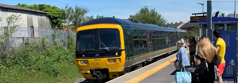
The train data works relatively well for local trains.
The bus data is stop by stop or route by route - neither of which quite is the quick, easy and pragmatic answer to a question like "where to I get the bus for Bath and what time does it get there". In some cases (such as to Bath) there are different routes within Melksham, and it's far from obvious when you find a stop offering services to Bath that there might be other services available just up the road. Route by route, sadly, means you have to look up the 271, 272, 273, x76 and UCB if you want to know about the complete service to Bath. Services that operate on a loop (most 271 journeys and some 14s) show a terminus and won't let you go on through in planning. It IS good but it's far from complete. And it just links you to the operator's website if you want to know what the journey will cost you.
Journeys that are indirect (involving changes on some or all journeys) are even more of a challenge - the best way is to put your start and end points into Google, or for a train journey into an online journey planner. Google comes up by default with driving instructions and there's an icon / button that lets you switch to public transport - usually pretty good in terms of giving you route ideas, but with an assumption that everything will be on time and that some mighty short connections can be made.
As an example, try https://www.google.com/search?q=melksham+to+calne


Trains
Current DeparturesTrain Timetables 14.12.2025 - May 2026
• local services
• to Reading and London
• to Portsmouth, Southampton, Salisbury, Weymouth
• National Rail timetable
Journey Planners, fares and booking:
• GWR for UK
• Interrail (Europe itinaries)
• Rail Europe (Individual journeys)
Buses
Extra Saturday evening 273 from 1.9.2025• 14, 15 - Melksham Town Bus
• x34 to Chippenham, Trowbridge, Frome
• 271,2,3 to Bath and to Devizes [1.9.2025]
• 69 to Corsham, Bradford-on-Avon
• x76 to Calne, Marlborough, and to RUH • SB2 to Seend
• 401 to Heathrow and London
MyTrip - App to track local buses
Taxis
Listed in a random order:• Index - 01225 700800
• Nigels Taxi - 07976 165910
• Paul's Taxi - 07986 517319
• AAP - 01225 706133
• Adam's Cab - 07526 291 539
• Carols Cabs - 07894 873129
• Forest Taxis - 01225 705453
Cycling and walking
Section to be addedOther sites to visit
-
 Facebook
Visit us on Facebook -
 Great Western Railway
Your Train Operator -
 Faresaver buses
Local services from Melksham -
 FromeBus
Services within Melksham -
 Coffee Shop
Our Passenger forum -
 TravelWatch SouthWest
Co-ordinating User's voices -
 TransWilts CIC
Community Rail Partnership -
 Community Rail Network
Formerly ACoRP -
 Top of this page
-
Coming SOOOON ...
A new approach